The drone itself is just a flying machine, but combining it with an app can be very interesting. That's why Drone Deploy first released its drone application market, and DJI is united with the Drone SAR in life-saving activities. This month, Drone Deploy launched a dedicated channel for buying and selling drone apps. The installed base of drone app has grown tremendously in recent months, and the launch of the Drone Deploy app market is a natural fit. At the Commercial Drone Show, Drone Deploy and SLANTRANGE showcased the new "Geo TIFF Upload" feature. It uploads the complete SLANTRANGE map directly to the user's Drone Deploy account. SLANTRANGE CEO, Michael Ritter said: "Through the cloud-based solution of Drone Deploy combined with local information processing analysis, we provide a unique set of functions for agricultural drone users around the world. We can be in Drone Deploy The app market is excited to release its first app and expects to expand more features in the future." This cooperation is only the beginning. The Drone Deploy application market launched at this conference actually marks the birth of the first application market in the drone industry. The Drone Deploy app market has more than 15 applications and is available to third-party developers in the world's largest UAV 2D and 3D map model database to help them overcome business challenges. “Many companies are calling for seamless integration of drone data with their workflow, and many third-party organizations are developing solutions for the industry,†said Mike Winn, CEO and co-founder of Drone Deploy. “The Drone Deploy application market provides a one-stop integration opportunity for companies like Box and John Deere, a big step for commercial drone users.†The application market, launched on the Drone Deploy platform, provides a one-stop shop for cloud-based drone data analysis. Users can extend the functionality of Drone Deploy through third-party applications embedded in the Drone Deploy web and mobile (IOS and Android). "We are very excited to be part of the fast-growing UAV ecosystem," said Ross McKegney, director of platform at Box. “Our partnership with Drone Deploy helps our customers make better use of drone data in their operations.†According to PricewaterhouseCoopers, the emerging global commercial drone market will reach more than $127 billion in production by 2020. Bona Drone, a FAA Part 107 certified drone service provider, is one of the beneficiaries of this trend. Thanks to the exponential growth of the drone market and the company's emphasis on precision, Bon Air Drone has expanded to four locations in just one year and has a large stake in the mining and market research market. contract. “As a user who uses Drone Deploy aerial photography every day, I am very excited to see the release of the application market and new applications,†said Shell Air Drone director Shelly Engel. “They are a customizable platform that is a major revolution in the drone industry.†The Drone Deploy application market not only allows users to connect to the world's largest UAV imaging database, it also offers developers a variety of new opportunities. In fact, Drone Deploy has more than 10,000 users scattered across 135 countries and has mapped more than eight million acres (more than the land area of ​​Belgium), the world's largest drone map and 3D model database. . Now, developers can commercialize drone applications and easily distribute applications on the platform, the first time in the commercial drone industry. Those first-time apps offer a wide range of features: sharing with Box documents, importing land boundaries from My John Deere, exporting data to Autodesk, 3D printing of drone maps with White Clouds, and immediate aviation insurance through Verifly. Other applications include Air Map flight control software, EZ3D roof inspection software, Drone Logbook, Flyte, Kittyhawk, NVdrones and Skyward flight recording software; and AglyTIx, Agri Sens, Birds.ai, SkymaTIcs, SLANTRANGE and Tensor Flight Agricultural software. Nicholas Pilkington, chief technology officer and co-founder of Drone Deploy, said: 'Until now Drone Deploy has focused on solving the core challenges of the drone field (around flight, data collection, processing and analysis). Now Drone Deploy is open to technology, so developers can use these technologies to focus on developing solutions in their field without having to reinvent the entire technology. For developers who want to use the Drone Deploy API for application development and distribution, please click on the link developer file. Users can also download integrated drone applications. The Drone Deploy app store has free and paid apps. The price mechanism for fee-based applications varies from acreage for agricultural applications to per-inspection reports for roof inspection applications. Once the new app is added to the account, the app will be integrated into the web and mobile interface of Drone Deploy in the appropriate area. For example, if an agricultural application is already installed, it may only be found on the Crop Health Data page, not the other interface of Drone Deploy. A full list of new applications is available on the Drone Deploy App Market. Another example of a drone function that has been greatly improved by the App is the cooperation between DJI and Drone SAR. The two companies announced a new search and rescue application that seamlessly integrates the aerial view of the drone with the mobile management software to ensure that the rescue team uses the drone efficiently in search and rescue. DroneSAR, the Irish technology startup, has overturned the entire search and rescue industry. The company said that their app supports the use of ordinary cameras or infrared cameras for live video and video, and broadcasts them to the operational command center and the ground search and rescue team in real time. The software can mark the GPS location of the rescue target and automatically send it by email or SMS, allowing the ground team to reach the target faster. The completed search and rescue routes will be fully recorded for forwarding to other search and rescue teams on the move. The software will design a flight path map based on different terrains to make the drone observe faster and more efficiently. The flight route will be adjusted according to various terrains, including hills, mountains, trees and flats. The software allows the user to select an automatic flight search mode in which flight paths are based on variables such as altitude, field of view, power, and the likelihood of finding a target. By organizing the process of data collection and providing a framework for managing and analyzing this data, DroneSAR ensures that drones are systematically used under specific search and rescue drafts, making rescuers safer and more efficient. “From the understanding of how to use this technology, to the communication of search results and data, to finding the most appropriate tactics, the first rescue responders will get huge benefits from the software and DJI hardware,†Dajiang Education Director Romeo Durscher said. “Many tasks and tactics in search and rescue operations will accelerate a lot with the help of automation, which will reduce the time to find rescuers and protect lives.†The app is the first drone search and rescue software developed in collaboration with the European Emergency Number AssociaTIon and the Donegal Mountain Searchand Rescue team in Ireland. The teams found that the walking five-person search and rescue team took an average of two hours to find the rescued person within 1 km, while a drone could complete the search within 20 minutes and at the same time perform other actions to support the rescue. "Our mission is to save lives," said Dr. Oisin McGrath, CEO and co-founder of DroneSAR. “Our software can reduce the risk of the rescue team and reduce the search time. If we can save even one life, this project is also successful for Drone SAR.†A mobile phone protective cover is a jacket designed and produced to protect the mobile phone. In the mid-to-late 1990s, mobile phone protective sleeves took advantage of the opportunity of slimming mobile phones to become popular, and their functions also protected the mobile phones for aesthetic purposes. phone case, cell phone case, phone cover Reteck Electronic Co., Ltd. , https://www.reteck.com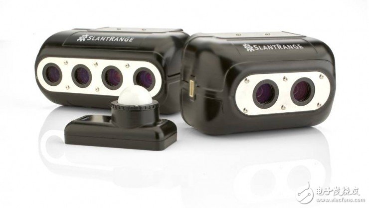

Its types are also diversified with the increase of mobile phone brands and functions. According to the texture, they are divided into leather, silicone, cloth, hard plastic, soft plastic, velvet and silk. According to the model, there are straight and The difference between the flip. Depending on the model, the applicable categories of mobile phone cases are also different. The candy bar can usually use all types of mobile phone cases, while the sliding type folding type can only choose leather cases.